Photographing Gibraltar Falls
About Gibraltar Falls
Gibraltar Falls drops across a broad granite face in the northern Namadgi landscape. The formal lookout gives the safest defining view, while nearby forest, rock and creek details complete the story.
This is Ngunnawal and Ngambri Country. The strongest coverage combines a defining view with medium studies and details that explain the geology, ecology, architecture or cultural setting.
Planning a photographic visit
A useful set of photographs should connect the granite cascade and its surrounding forest with the wider landscape. Begin with an establishing image, then work towards a tighter photograph of the most distinctive form and a detail that adds a sense of place.
Viewpoints
The first location: from the viewpoint platform.
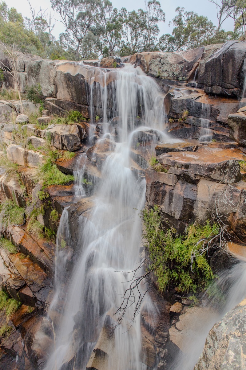
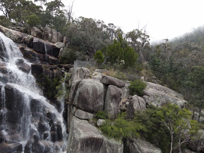
Gibraltar Falls lookout
Main waterfall view. Start with the defining environmental view, then vary height and focal length.
Useful lenses: 16–35mm and 24–70mm.
Falls trailhead
Short steep access path. Use this stop to add context or a contrasting visual rhythm.
Useful lenses: 24–70mm and 70–200mm.
Woods Reserve
Creek, campground and forest. Use this stop to add context or a contrasting visual rhythm.
Useful lenses: 16–35mm and 24–70mm.
Corin Dam
Reservoir and mountain landscape. Use this stop to add context or a contrasting visual rhythm.
Useful lenses: 24–70mm and 70–200mm.
Square Rock trailhead
Nearby granite walk. Use this stop to add context or a contrasting visual rhythm.
Useful lenses: 16–35mm and 24–70mm.
Working the viewpoints
Start at the designated viewing platform with a frame that explains the full waterfall. Make a second, tighter composition of the most interesting channels of water over granite; look for a third image that uses surrounding vegetation to establish the setting.
Water Flow & Conditions
Water volume responds to recent and seasonal rainfall. Moderate flow often retains more visible rock texture than flood conditions; never enter a creek or pool to improve a composition.
Other Things to Look Out For
- Directional light, cloud, mist and changing weather
- Characteristic textures and small details
- Wildlife observed quietly with a long lens
- Human scale where it strengthens the story without compromising privacy
Look for a supporting image that records the surrounding vegetation, characteristic surface textures or a changing weather condition. Use a longer lens for wildlife and keep a respectful distance. The lookout and approach can be affected by closures and weather. Check ACT Parks alerts immediately before visiting, stay behind barriers and do not descend onto wet rock to improve an angle.
Location
Gibraltar Falls, Namadgi National Park, Australian Capital Territory
Approximate photographic centre: -35.48750, 148.91670
Map markers identify photographic objectives, not guaranteed parking places or permission to leave formed public access.
Apple Map – Waterfall and Nearby Photographic Locations
The falls are located within the Tidbinbilla Sanctuary. Nearby are the Lanyon Homestead, Lambrigg's Lookout, John's Peak, and of course the Tidbinbilla Tracking Station aka Canberra Deep Space Communication Complex at 421 Discovery Drive, Paddy's River.
Photographic locations
How to Get There
The falls are about 45mins drive from Canberra. I am not aware of any public transport to the site. It is not a hard drive though, as Canberra is well served with freeways. My suggestion is to take a loop going from Canberra to Tuggeranong, Woodcock Drive, Point Hut Rd / Tidbinbilla Rd, then up Corin Rd to the Falls. On the return trip though, once Corin Rd hits Tidbinbilla Rd, turn left and follow the road up past Cotter Dam and back to the city via Cotter Rd. There are several good photographic points along this road.
From Canberra, use the Apple Maps route. Allow extra time for unsealed roads, congestion and photographic stops.
Apple Map – Driving from the State Capital
The route ends at the road-accessible destination configured above. Driving distance and time are Apple Maps estimates.
State capital to destination
Calculating the driving route with Apple Maps…
Current Access / Conditions
Conditions checked: 22 September 2026.
Use only the fenced lookout and formed track. Wet granite and cliff edges are hazardous; do not cross barriers or descend toward the falls.
Obey every closure, barrier and on-site instruction. Carry water, offline navigation and clothing suitable for changing conditions.
Best Time to Visit
Canberra has hot summers and cold winters. It is one of the few places in Australia where it actually snows during winter (only once or twice every few winters - but still). I suggest anytime that you happen to be in Canberra is reasonably good time to visit the falls. It is clearly nicer on a hot summers day - but this is also when lots of people will visit the falls. So "off-peak" is better for photography.
Dawn and late afternoon usually provide the most dimensional light; overcast weather can be preferable for forest, waterfalls and architectural detail. Recheck sunrise direction, weather, tide or water flow for the exact date.
Accessibility
Expect conditions ranging from accessible paved areas to uneven natural tracks. Wear suitable footwear, keep clear of edges and moving water, and do not rely on mobile reception.
Nearby Locations
Where to Stay
Stay in the nearest service centre or approved on-site accommodation where available. A local base makes dawn and twilight sessions safer and leaves time to return in different conditions.
Photography Recommendations
Photography recommendations
- Make the principal waterfall view before experimenting with tighter studies of the cascades, rock and surrounding bush.
- Overcast conditions are especially useful here because they reduce contrast on wet rock and foliage.
- For silky water, use a tripod and a low ISO; choose shutter speed to retain some texture rather than automatically making the water completely featureless.
- Protect highlights in white water and watch slippery rock and track edges—do not leave the formed viewing areas for a composition.
Exposure and composition in the field
Soft overcast light is helpful for balancing pale water, reflective granite and dark foliage. Compare a moderately quick shutter that retains water texture with a slower exposure, checking the highlights after each change. Check the histogram rather than judging the rear-screen preview alone; make a second composition after changing focal length or camera height.
Photographing Moving Water
Begin around 1/4 to 1 second, review water texture, and adjust rather than assuming a very long exposure is best. A polariser can control glare; clean spray from the lens after every sequence.
Suggested Photographic Sequence
- Walk to the official viewing area and make a natural-looking exposure first.
- Set the tripod for the main falls composition and vary shutter speed.
- Make tighter images of cascades, rock patterns and vegetation.
- Finish with wider environmental frames that show the falls within the valley.
Before leaving, compare the establishing frame with the tighter subject and one contextual detail. If the light has changed, remake the strongest composition rather than simply taking more versions of the same view.
How Long Should a Photographer Stay?
Allow about 1–1.5 hours for photography at the falls, plus walking time; 2 hours gives more freedom to wait for softer light or fewer visitors.
My Priority Photographs
- A defining environmental portrait of Gibraltar Falls
- A tighter image of the location’s characteristic structure or texture
- A composition that communicates scale
- A second image made in distinctly different light or weather
A coherent final set should include the granite cascade and its surrounding forest, a more selective study, and one frame that shows the character of the surrounding landscape.
Waterfall Information
| Waterfall | Gibraltar Falls |
|---|---|
| Drop | approximately 50 m over multiple tiers |
| Setting | Namadgi National Park, Australian Capital Territory |
| Best flow | After sustained rain, subject to safe and open access |
Include only facts that can be verified. Remove rows that are not relevant or cannot be reliably documented.
Photo Subjects
Explore related Auspano photography guides by subject.
Photographer Comments & Updates
Have you photographed this location? Share your photographs, viewpoints, photography tips or recent access updates, or ask a question about visiting. When uploading your own photographs, please include your name and the date each photograph was taken. Date any access or track-condition observations; visitor reports may become outdated, so check official information before travelling.