About Shepards Lookout
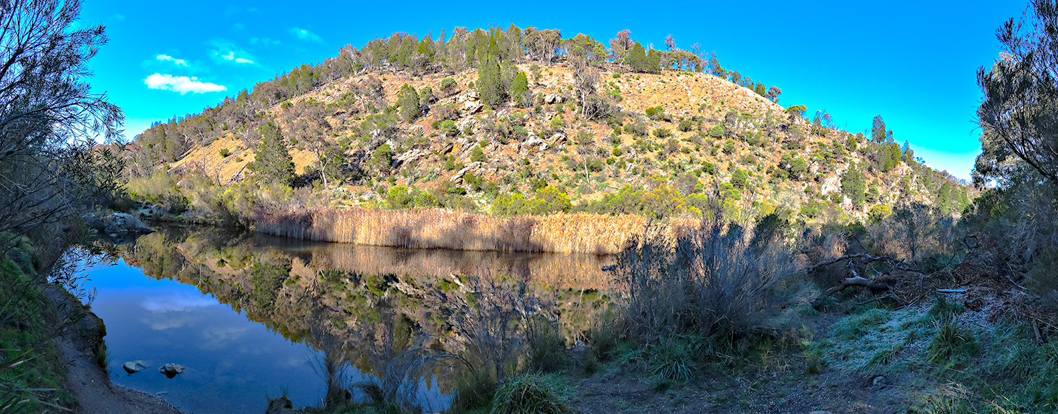
Shepards Lookout is a lovely lookout over the Moloongo River. The view is several hundred feet above the river, while the river does a horseshoe like bend below. Above the river are some views of the nearby Brindabella hills.
Planning a photographic visit
A useful set of photographs should connect the river bend, steep valley sides and Brindabella backdrop with the wider landscape. Begin with an establishing image, then work towards a tighter photograph of the most distinctive form and a detail that adds a sense of place.
Viewpoints
There really is only one viewing position, and that is from the viewing platform. If you walk left from the viewing platform, their is a trail that takes you back to the main path. In the first few metres of this walk, their are some slightly different views of the hills and river, but I found then obscured by trees and not really worth a wide angle shot. A little later on the walk, you get to see the water treatment plant, with a path down towards it. While this is a different view, I did not consider it photogenic.
There are two other choices:
- From the Upper Lookout. I dont particularly like this view. If you cant go down the steps, then it is clearly a chance to see the falls, but from a photography perspective there is too much bush in the way for my liking.
- From the Lower Lookout. Here you are in the river valley, and facing the falls straight on. The sides of the valley limit the range of perspectives avaiable, but they dont stop your cropping and composition. Changing the perspective to the right of the platform gave the images below. The second image being just a crop of the first to elimate the bundle of sticks at the bottom right hand side.
Working the viewpoints
Keep the main viewing platform as the principal position, as described in your original account. Try a wide landscape that shows the bend, then use a longer focal length to isolate the watercourse and successive ridges; take care not to let foreground branches obscure the river.
Other Things to Look Out For
I took my LowePro Backpack loaded with Canon 5DMkII body, Canon 24-105mm zoom, Manfrotto 190 Tripod, and of course a range of lens wipes, spare batteries, sunscreen and bug repellant. I tended to shoot 28-55mm
Techniques
As with any waterfall, I want to blur the water but not the surrounding vegitation. That means using a long exposure and a tripod. I could have used NR filters, but in this case I didnt. I simply changed the aperature to suit. I was already shooting at ISO 100.
Look for a supporting image that records the surrounding vegetation, characteristic surface textures or a changing weather condition. Use a longer lens for wildlife and keep a respectful distance. The lookout is elevated above steep terrain. Remain on the formed track and behind any barriers; the river is not accessible from the viewing platform.
Nearby Locations
Nearby photographic locations
Location
Shepards Lookout 315 Stockdill Drive ///situated.acre.notions (-35.240945° 148.977122°)
Shepards Lookout, Murrumbidgee River Corridor, Australian Capital Territory
Approximate coordinates: -35.24095, 148.97712
Markers identify photographic objectives, not guaranteed parking positions or open access.
Apple Map – Location and Nearby Photographic Locations
This Apple Map shows the principal photographic subjects and nearby locations. Verify cultural restrictions, signs, road status and track conditions before relying on a marker for access.
Photographic locations
How to Get There
The only way there is by private car. The road is well made, but not very wide. Shepards Lookout is a 10 min drive from the Western Suburbs of Canberra, and about 20-30 min from anywhere in Canberra. The (small) carpark is on Stockdill Drive Holt (Belconnen).
Driving from the State Capital
The state capital is used as a consistent reference point. Apple Maps calculates the automobile route to this location; your actual route may vary with your starting point, traffic, roadworks and temporary closures.
State capital to destination
Calculating the driving route with Apple Maps…
Distance and travel time are Apple Maps estimates and may change with the route and current conditions.
Current Access / Conditions
Conditions checked: 22 September 2026.
Check current ACT Parks and Emergency Services alerts immediately before travel. Fire, storms, flooding, heat, maintenance and road damage can change access quickly.
Obey closures and remain on formed public routes. Carry water, offline navigation and clothing appropriate to rapid weather changes.
Best Time to Visit
I visited the site on a day with lots of fog - infact I thought the site would be in fog until I was within a kilometer of it. The fog / cloud gave some good texture and interest to the hills, and I liked the results. I also think this would be a nice spot on a sunny day, but probably early or late in the day in order to create some shadows across the hills.
Canberra is between Melbourne and Sydney, but it is relatively high altitude for Australia (300M or 1000'). This means that it is hot in Summer, and cold in Winter. In winter there is snow on the nearby hills and it snows occasionaly in the city. From a photography point of view, all times of the year are fine.
Accessibility
I cannot recall the entry to the path from the carpark - I think it had some bollards to stop cars and motorbikes entering the path - but apart from this, the path is wide open firm dirt path and almost totally flat. I would feel comfortable taking a wheelchair down the path.
Where to Stay
Choose the nearest service town or on-site accommodation where available. Staying locally makes dawn and evening work safer and reduces repeated driving on unfamiliar roads.
Photography Recommendations
Photography recommendations
- The principal subject is the Murrumbidgee valley and its receding ridges; use the lookout edge to build layered landscape compositions.
- A telephoto is excellent for isolating bends, ridges and atmospheric layers, while a wider lens can include foreground bush.
- Early or late directional light gives the valley more depth than midday sun.
- Do not trade safety for a cleaner foreground—work from the established lookout and track.
Exposure and composition in the field
Directional light gives the valley walls relief, while light haze can separate distant hills. A polariser may reduce reflections on foliage but can also remove useful light from the river surface. Check the histogram rather than judging the rear-screen preview alone; make a second composition after changing focal length or camera height.
Suggested Photographic Sequence
- Start with a wide valley view from the lookout.
- Use a telephoto to explore river corridor and ridge layers.
- Make vertical and horizontal versions using nearby vegetation as a frame.
- Revisit the best composition when light reaches the valley walls.
Before leaving, compare the establishing frame with the tighter subject and one contextual detail. If the light has changed, remake the strongest composition rather than simply taking more versions of the same view.
How Long Should a Photographer Stay?
Allow about 1–1.5 hours at the lookout, or 2 hours if waiting for low-angle light.
My Priority Photographs
- A defining environmental view of Shepards Lookout
- A tighter photograph of its characteristic details
- A composition communicating scale
- A weather-driven or low-light image
A coherent final set should include the river bend, steep valley sides and Brindabella backdrop, a more selective study, and one frame that shows the character of the surrounding landscape.
Photo Subjects
Explore related Auspano photography guides by subject.
Photographer Comments & Updates
Have you photographed this location? Share your photographs, viewpoints, photography tips or recent access updates, or ask a question about visiting. When uploading your own photographs, please include your name and the date each photograph was taken. Date any access or track-condition observations; visitor reports may become outdated, so check official information before travelling.