Photographing Flinders Ranges
About the Flinders Ranges
The Flinders Ranges are a mountain range on the edge of the desert (outback). The light from the desert strikes these hills and illuminates different colours. The hills can range from green (trees), to red rocks, to blue depending on the time of day and angle. The ranges are an extended area from south of Port Pirie (Southern Flinders Ranges) up passed Quorn (where the Flinders Ranges 'proper' start), and then up passed Hawker, Wilpena, Blinman, Liegh Creek to Arkoola. This is several hundred kilometres.
The area is generally desert-ish plains, with steep sided ranges poking up at the edges. There is some 2 wheel drive asphalt roads through the area, but many of the roads (really tracks) are 4x4 only. In general, the area is remote. (i.e. this is outback - come prepared). Fuel and food can be purchased in Hawker (our preference) and Blinman.
South Australia - Flinders Ranges and Outback is a government site that has a range of really good info on the area.
Travel through the ranges
A typical trip might include: Wilpena Pound Lookout, SA, Bunyeroo Gorge, SA, Brachina Gorge, SA, Arkaroo Rock, SA, Aroona Valley Lookout, SA, Stokes Hill Lookout, SA, Blinman Historic Town, SA, Moralana Scenic Drive, SA.
Planning the photographic story
A varied set of photographs connects flinders ranges ridges, gorges and ancient rock with the wider setting. Begin with a broad view, then a tighter study and one distinctive detail.
Viewpoints
The number of veiwpoints here is literally in the thousands. It is a location that photographers tend to spend 7-14 days in. The area is large, and there are many little tracks to follow. The angle of the sun (and rare clouds) change the colours of the hills. Dawn and Sunset here are great - the question is where to be for them.
- . .
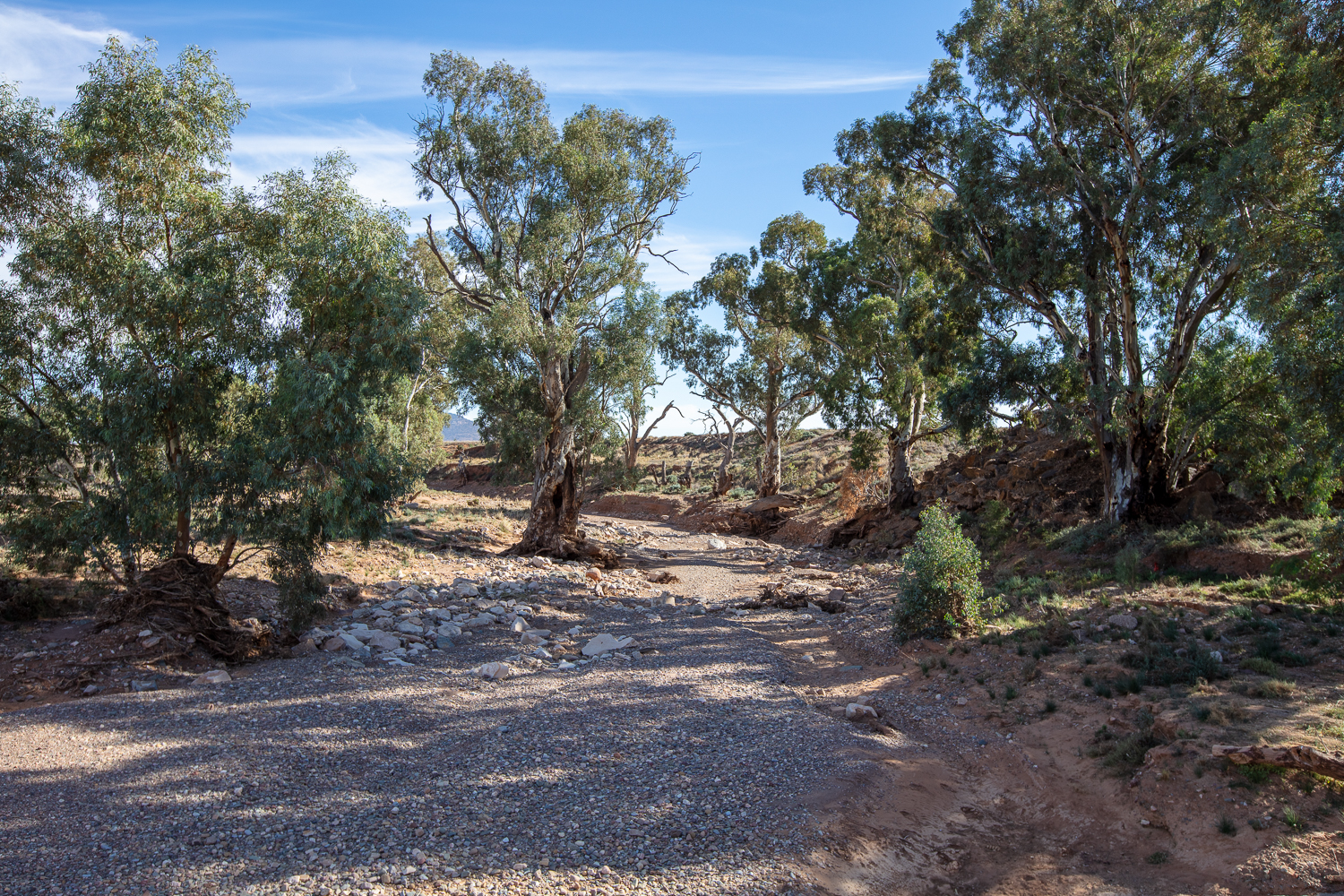
Flinders Ranges River Crossings - nn
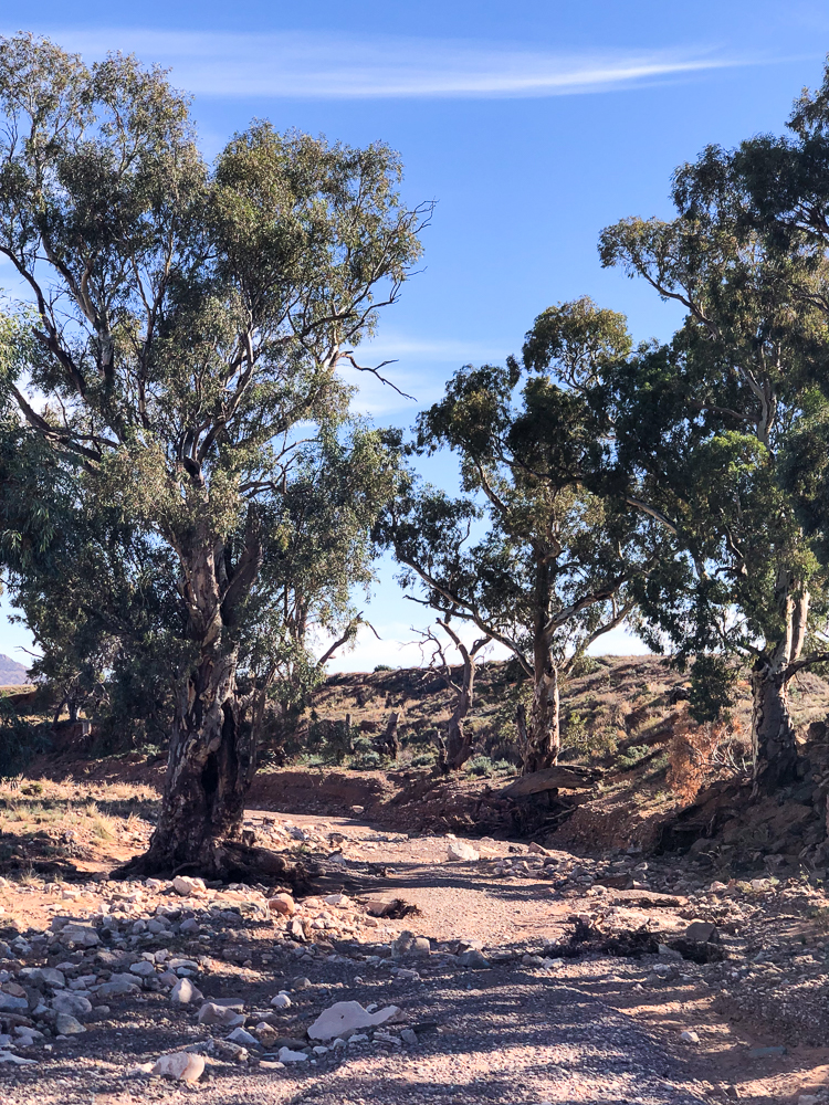
Flinders Ranges River Crossings
Working the viewpoints
Tell the landscape in three scales: an elevated range panorama, a gorge composition and a detail of rock strata or vegetation.
Other Things to Look Out For
How I photographed the Flinders Ranges
What I took - what was in my kit
I have been to the Flinders Ranges, but not to some of the better spots. Not knowing what the environment would be like, I took my LowePro Backpack loaded with Linhof Technorama with Velvia 100 film for the panorama, and Canon 5DSR body, Canon 24 mm TS, Canon 16-35mm, 50mm Sigma Art, and Canon 70-200mm Lenses, Manfrotto 190 Tripod, and of course a range of lens wipes, spare batteries, sunscreen and bug repellant.
Nearby Locations
Nearby photographic locations
Location
Flinders Ranges, Flinders Ranges, South Australia
Approximate coordinates: -31.44900, 138.75700
Markers identify photographic objectives, not guaranteed parking positions or open access.
Apple Map – Location and Nearby Photographic Locations
This Apple Map shows the principal photographic subjects and nearby locations. Verify cultural restrictions, signs, road status and track conditions before relying on a marker for access.
Photographic locations
How to Get There
The Flinders Ranges are in South Australia, some 450kms due north of Adelaide. The town of Hawker promotes itself as the entrance to the Flinders Ranges, and this is a reasonably accurate description. From a photographic point of veiw, the ranges take in several other ranges such as Southern Flinders Ranges, Gammon Ranges and Nilpena Ediacara National Park.
Driving from the State Capital
The state capital is used as a consistent reference point. Apple Maps calculates the automobile route to this location; your actual route may vary with your starting point, traffic, roadworks and temporary closures.
State capital to destination
Calculating the driving route with Apple Maps…
Distance and travel time are Apple Maps estimates and may change with the route and current conditions.
Current Access / Conditions
Conditions checked: 22 September 2026.
Check current South Australian park and outback-road alerts immediately before travel. Fire, storms, flooding, heat, maintenance and road damage can change access quickly.
Obey closures and remain on formed public routes. Carry water, offline navigation and clothing appropriate to rapid weather changes.
Best Time to Visit
Best season and light
Use the cooler or drier season for longer walking and remote travel, then favour dawn and late afternoon for dimensional light. Overcast conditions suit forest, architecture and detail; clear twilight is valuable for city and desert work.
Light in the field
Early and late side light defines folded ridges; broken cloud can create useful bands of light.
Accessibility
We drove to, and through, the Flinders Ranges in a 2 wheel drive car. That said, there are many dirt roads and poor roads here, so a typical 4 wheel drives clearance, suspension and 4WD ability will not hurt. There are some tours for 4X4 cars - i.e. those cars that have: 4 wheel drive, lockable differentials, and high ground clearance. Most hire car firms specifically ban taking their cars into places like this due to the likelihood of damage to the underneath of the car. You can get to Willow Springs via nice asphalt roads though. Many roads throughout the Flinders Ranges are 2 wheel drive accessable - but certainly not all.
Field access and safety
Check national park alerts and unsealed-road conditions; avoid entering closed tracks after rain.
Where to Stay
We stayed at Hawker, which has two hotels and a caravan park. There are many other options though from station stays (e.g. Edeowie Station $30 per night (20241018)) through to Wipena Pound Discovery Resort ($282 per night (20241018)), and Prairie Hotel & Outback Lodge ($690). The area is popular though, and while I have not looked for free camps, I think that if you are attempting to free camp, then you should get into camp early.
Photography Recommendations
Photography recommendations
- Plan the Flinders Ranges around several distinct subjects: layered ranges, river red gums, gorges, historic structures, wildlife and road viewpoints.
- Prioritise sunrise and late-afternoon light for the ranges; use the middle of the day for gorges, details, walks and scouting.
- Carry a telephoto as well as a wide lens—the telephoto is often the better tool for compressing ridge layers, isolating gums and photographing wildlife without approaching it.
- Use roads and tracks only from safe stopping places, and treat changing weather, dust and cloud as part of the landscape rather than a reason to stop photographing.
Composition and exposure
Tell the landscape in three scales: an elevated range panorama, a gorge composition and a detail of rock strata or vegetation. Early and late side light defines folded ridges; broken cloud can create useful bands of light. Review highlights and make a second deliberate framing rather than repeating the same viewpoint.
Suggested Photographic Sequence
- Scout the next sunrise or sunset viewpoint in daylight where possible.
- Use sunrise for a broad range or Wilpena/Ikara-area landscape, then work trees, gorges and details through the morning.
- Use midday for walking, heritage subjects and scouting rather than forcing flat broad landscapes.
- Return to an open ridge/valley viewpoint for late light, then use twilight only where the return route is safe.
Suggested field sequence
Begin with flinders ranges ridges, gorges and ancient rock. Follow with a tighter detail and a context photograph; return to the strongest composition if the light changes.
How Long Should a Photographer Stay?
Allow a minimum of 3–4 days for a photographic visit to the Flinders Ranges; 5–7 days is much better if you want several dawn/sunset sessions, drives and walks without rushing.
My Priority Photographs
- A defining environmental view of Flinders Ranges
- A tighter photograph of its characteristic details
- A composition communicating scale
- A weather-driven or low-light image
Priority frames
Secure an establishing photograph of flinders ranges ridges, gorges and ancient rock, a selective detail and one image that explains the surrounding setting.
Photo Subjects
Explore related Auspano photography guides by subject.
Photographer Comments & Updates
Have you photographed this location? Share your photographs, viewpoints, photography tips or recent access updates, or ask a question about visiting. When uploading your own photographs, please include your name and the date each photograph was taken. Date any access or track-condition observations; visitor reports may become outdated, so check official information before travelling.