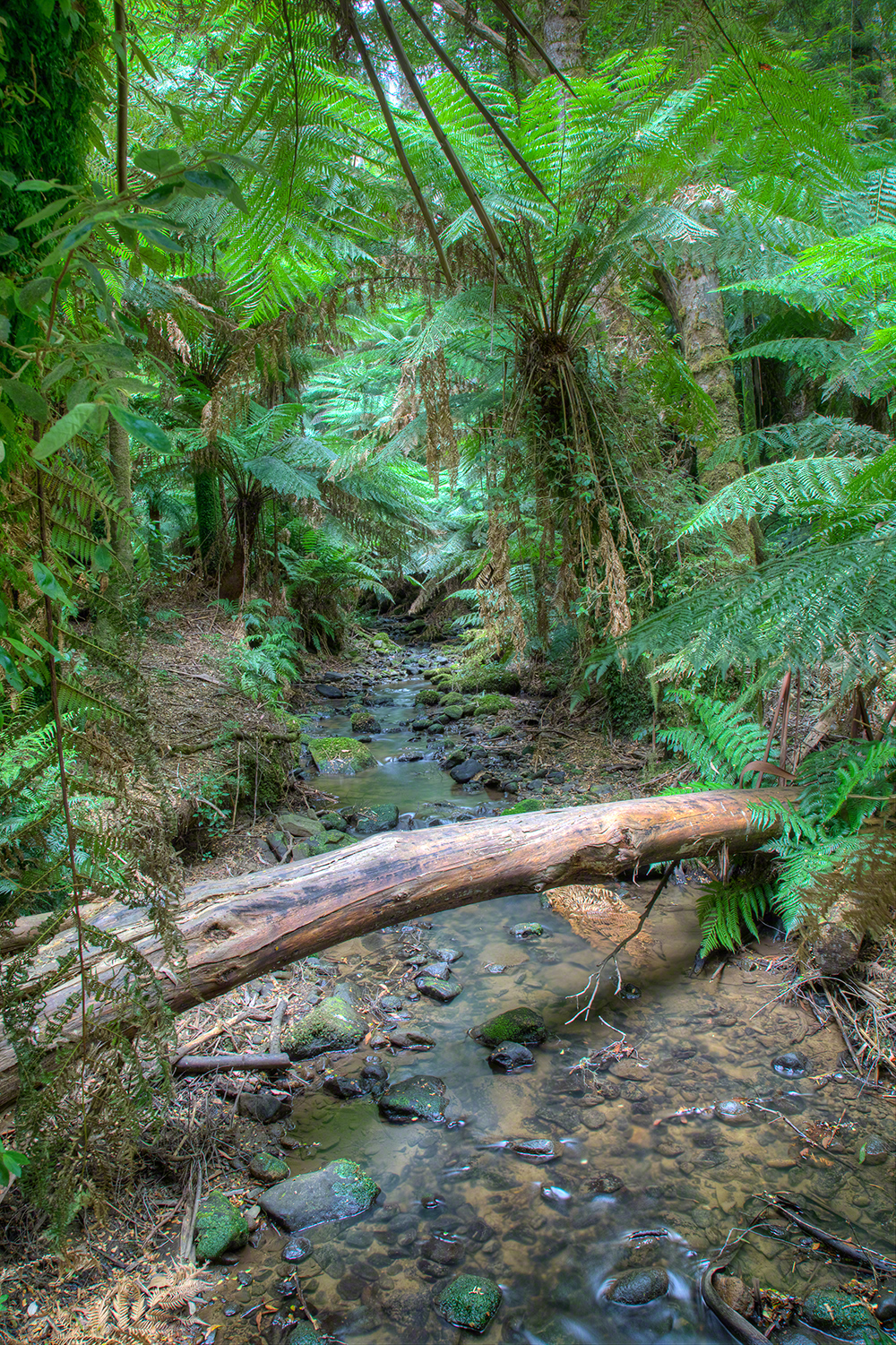
Bruthen Creek Falls is a small waterfall on Bruthen Creek near Carrajung in Gippsland. It is not a large or famous waterfall; for me, much of its attraction is the quiet bush setting and the feeling of discovering water in a densely vegetated part of the Strzelecki country.
I was brought up in country Victoria and places like this remind me of the hilly, wet forest country I visited as a child: tall eucalypts above tree ferns, with fallen timber, smaller ferns and dense undergrowth below. That layered vegetation is an important part of the photographic character of Bruthen Creek Falls rather than simply background to the water.
Victorian Government place-name records identify Bruthen Creek Falls as a long-standing name in Wellington Shire and locate it in the headwaters of Bruthen Creek. The Victorian Fisheries Authority describes Bruthen Creek in this district as a small, fast-flowing creek, generally only about 2–3 metres wide in its upper reaches.
Viewpoints
At the base of the falls
The direct front-on position gives the most obvious view of the falls. On my previous visit, branches and other debris washed down by storms made the base visually untidy, so this was not my favourite composition.
Right of the base
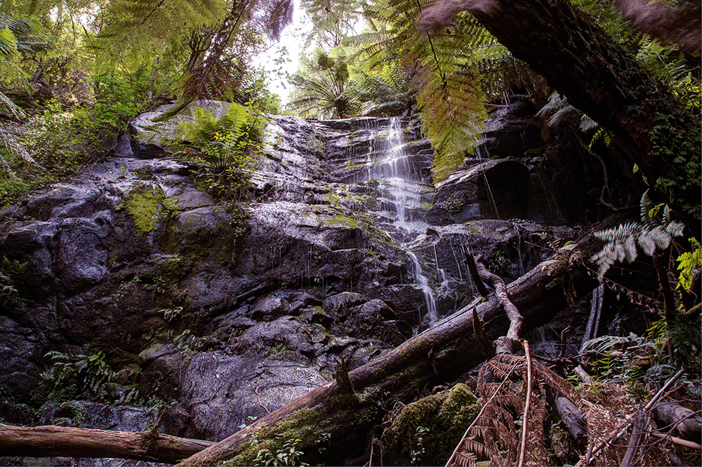
I found a more successful viewpoint slightly to the right, along a small animal path. From here I could use foreground vegetation to hide some of the clutter at the bottom of the falls and make the composition feel more like the surrounding forest.
The tributary and forest details
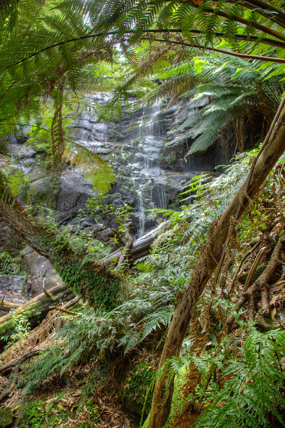
The small stream entering Bruthen Creek just below the falls is also worth photographing. My photograph at the top of this page is of this stream rather than the main falls. Ferns, wet rocks, fallen timber and small cascades can provide stronger photographs when the main waterfall itself is cluttered.
Water Flow & Conditions
Bruthen Creek is a small watercourse, so the photographic character of the falls is strongly dependent on recent rainfall. My experience of this part of Gippsland is that winter and wetter periods generally provide better flow, cleaner foliage and richer colour in the undergrowth. Summer can bring lower flow and dustier vegetation.
I would favour a visit after useful rain, but not necessarily during or immediately after very heavy rain. Moderate flow should retain texture in the water and make it easier to balance the white water against the dark forest. High flow may also move branches and debris through the creek and make the steep bank and wet rocks more hazardous.
Important: I have not found a reliable public real-time flow gauge for Bruthen Creek Falls. Treat the flow description here as general guidance rather than a guarantee of conditions on the day.
Other Things to Look Out For
Do not concentrate only on the main drop. This is a forest-waterfall location, so look for small tributaries, minor cascades, wet rocks, tree ferns, fishbone ferns, moss, fallen timber and patterns in the water.
The dense vegetation can also be used deliberately to frame the waterfall or hide unattractive storm debris. On my earlier visit this produced a better composition than the unobstructed front-on view.
Nearby Tarra-Bulga National Park is particularly valuable for rainforest photography, with Mountain Ash, fern gullies, ancient Myrtle Beech, fungi and smaller streams providing complementary subjects.
Location
Bruthen Creek Falls
Fergusons Road area, Carrajung, Victoria 3844
Approximate coordinates: -38.387196, 146.670838
The falls are in the headwaters of Bruthen Creek in Wellington Shire. They are a small bush waterfall rather than a developed visitor attraction, so do not expect a formal viewing platform, marked walking trail or visitor facilities at the falls.
Apple Map – Waterfall and Photographic Locations
The Apple Map separates the approximate waterfall position from the Fergusons Road approach and identifies complementary rainforest subjects in Tarra-Bulga National Park. Bruthen Creek Falls has no formal car park, signed trail or viewing platform. Treat the road marker as an orientation point only and stop only where it is legal and completely safe.
Photographic locations
How to Get There
From Melbourne, travel east on the Princes Freeway/Highway to Traralgon, then head south towards Gormandale and Willung South. Approach the Carrajung end of the Grand Ridge Road (C484) and turn onto Fergusons Road for the final approach to the falls.
The falls are close to the road, but this is not a conventional signed waterfall stop. My earlier visit found no formal car park and no formed walking track down to the falls. Use the coordinates and map to identify the location and park only where the vehicle is completely clear of the roadway and where stopping is legal and safe.
The wider Grand Ridge Road/Tarra-Bulga area contains narrow, winding and unsealed roads. Parks Victoria specifically advises care on the Grand Ridge Road because it is unsealed and is used by logging trucks. Conditions can change after heavy rain, storms or forestry activity, so check local road conditions before travelling.
Driving from Melbourne
Melbourne is used as a consistent reference point. Apple Maps calculates a driving route to the mapped Fergusons Road approach. It does not confirm a legal parking place, public access across adjoining land or safe pedestrian access to the waterfall; assess all three on arrival.
Melbourne to the Fergusons Road approach
Calculating the driving route with Apple Maps…
Distance and time are estimates and may change with traffic, roadworks, forestry operations and road conditions.
Current Access / Conditions
Information checked September 2026. I have not found an official developed visitor site or current formal track description specifically for Bruthen Creek Falls. The falls remain mapped as a place near Carrajung, but visitors should regard access from Fergusons Road as informal.
Because my earlier access involved descending a steep bank without a formed track, conditions should be assessed on arrival. Wet vegetation, loose soil, fallen branches and slippery rocks can materially change the difficulty after rain—the same rain that improves the waterfall photographically.
If combining the visit with Tarra-Bulga National Park, check Parks Victoria's current changed-conditions information before travelling. Parks Victoria currently also carries an H5 bird-flu warning: do not touch or approach sick or dead birds or other wildlife.
Best Time to Visit
Best season
Winter and spring are the most promising starting points because the surrounding country is generally wetter and the creek is more likely to have useful flow. Autumn can also be attractive after rain and is particularly good for fungi in the wider Tarra-Bulga forests.
Best weather
Bright sun penetrating a dark forest can create extreme contrast and distracting highlights. Overcast conditions, light rain or the soft light immediately after rain are usually more cooperative for waterfall photography and can intensify greens in the vegetation.
Best time of day
The priority is even light rather than sunrise or sunset. Aim for a time when direct sunlight is not striking patches of water or foliage. If the day is clear, earlier or later light may be easier to control than the middle of the day.
Accessibility
This is not an accessible waterfall in the conventional visitor-facility sense. On my previous visit the final approach involved descending a steep bank of roughly 10 metres through vegetation without a formed walking track.
The surface may be slippery after rain, and wet rocks, fallen branches and loose ground should be expected around the creek. It is not suitable for wheelchairs or people who require a formed path. Do not descend if the bank or creek conditions appear unsafe.
Nearby Locations
Tarra-Bulga National Park
The strongest nearby photographic destination. Parks Victoria describes giant Mountain Ash, fern gullies and ancient Myrtle Beech, with excellent opportunities for forest, fungi, fern and wildlife photography. The Corrigan Suspension Bridge and rainforest walks around Balook are particularly useful.
Cyathea Falls
Reached on the Tarra Valley Rainforest Walk in Tarra-Bulga National Park. Parks Victoria lists the walk as about 1.4 km return through rainforest and across small mountain streams. This makes a natural second waterfall subject for the same trip.
Tarra Valley and Balook
Good bases for cool-temperate-rainforest photography, especially after rain or in mist.
Yarram
Useful as a service and accommodation base, with additional photographic interest in the town's murals and the surrounding South Gippsland landscape.
Traralgon and the Latrobe Valley
A larger service centre to the north, with very different industrial and rural landscape subjects if you want to broaden the trip beyond rainforest and waterfalls.
Where to Stay
For Bruthen Creek Falls I would choose accommodation according to whether the trip is primarily about the waterfall and Tarra-Bulga forests, or whether it is part of a broader Gippsland trip.
Yarram
Ship Inn Motel & Functions
480 Commercial Road, Yarram VIC 3971
Telephone: (03) 5182 5588
Yarram is a practical southern base with shops and services and gives good access to the Tarra Valley side of the district.
Traralgon
BIG4 Traralgon Park Lane Holiday Park
5353 Princes Highway, Traralgon VIC 3844
Telephone: (03) 5174 6749
Traralgon Serviced Apartments
18A Peterkin Street, Traralgon VIC 3844
Telephone: (03) 5176 0377
Traralgon provides the widest range of services and is useful if Bruthen Creek Falls is one stop in a larger Latrobe Valley/Strzelecki trip.
Accommodation details can change; confirm directly before travelling.
Photography Recommendations
Standard zoom: probably the most useful lens. A 24–70 mm equivalent gives enough width for the waterfall in its forest setting while allowing tighter compositions of water and vegetation.
Wide-angle: useful where the bank and vegetation restrict how far you can move back, but watch for stretched foreground vegetation and empty corners.
Short telephoto: a 70–200 mm is useful for isolating smaller cascades, fern details and sections of the main fall.
Tripod: strongly recommended. The forest is dark and the most useful shutter speeds for moving water are often too slow for hand-held work.
Polarising filter: particularly useful here for controlling reflections from wet leaves and rocks and increasing colour saturation after rain.
ND filter: useful when ambient light is too bright to obtain the desired shutter speed, although the forest itself may already provide several stops of light reduction.
Lens cloths: worth keeping immediately accessible. Dripping vegetation and spray can put small droplets on the front element without being obvious through the viewfinder.
Photographing Moving Water
Do not automatically use the longest exposure
I like blurred water, but I would bracket shutter speed rather than assume that several seconds is best. Try exposures around 1/4 second, 1 second and several seconds. Moderate shutter speeds can preserve lines and texture in a small fall that can disappear into featureless white with a very long exposure.
Protect the highlights
The difficult exposure is bright white moving water against deep forest shade. Check the histogram and highlight warning carefully. My earlier approach was to expose the water very brightly while retaining usable highlight detail, then recover the much darker forest through RAW processing or exposure blending where necessary.
Use the polariser deliberately
Rotate the polariser while watching wet rocks and foliage, not just the water. Maximum polarisation is not always best; retaining some reflection can give wet rocks shape and life.
Bracket difficult forest light
Where bright sky or openings in the canopy appear behind the falls, exposure bracketing can be more useful than trying to force the entire scene into one frame.
Check every frame for spray
At a waterfall, a single unnoticed droplet can spoil the sharpest part of a photograph. Clean the front element regularly and take duplicate frames after cleaning.
Suggested Photographic Sequence
- Before descending, assess the creek flow, bank condition and safe route back to the road.
- Photograph the wider forest setting before disturbing wet vegetation around the creek.
- Work the direct base viewpoint with several shutter speeds.
- Move to the right-hand viewpoint and use vegetation to frame the falls or hide debris.
- Use the standard zoom and telephoto for tighter studies of individual cascades, wet rocks and ferns.
- Photograph the small tributary below the falls and other intimate water details.
- Before leaving, repeat the strongest composition if the light or water appearance has changed.
How Long Should a Photographer Stay?
Allow about 1–2 hours for Bruthen Creek Falls itself if access is straightforward. The waterfall is small, but the confined forest encourages slower, tripod-based work and experimentation with shutter speed.
For a photographic day, I would combine it with Tarra-Bulga National Park and Cyathea Falls. A full day then becomes easy to justify; two days are worthwhile if you want to photograph the forests in different weather or light.
My Priority Photographs
- The main fall from the right-hand viewpoint, using vegetation to simplify the base.
- A clean front-on photograph of the whole fall when storm debris is minimal.
- The small tributary entering Bruthen Creek below the falls.
- A medium-telephoto study retaining texture in the falling water.
- Wet ferns and rocks with reflections controlled by a polariser.
- A wider environmental composition showing the waterfall within the layered forest.
- Small cascades and abstract water details after rain.
Waterfall Information
| Waterfall | Bruthen Creek Falls |
|---|---|
| Watercourse | Bruthen Creek |
| Waterfall type | Small forest waterfall / cascade; a more precise classification has not been reliably documented |
| Height | Not reliably documented |
| Flow | Small creek; flow is strongly influenced by rainfall |
| Best flow | Generally after useful rain, subject to safe access |
| Viewing positions | Base of falls; right of base; creek and tributary details |
| Walk to falls | Very short informal approach from the road; no formed waterfall track documented |
| Track difficulty | No official walking-track grade found; steep informal bank descent |
| Road access | Approach includes unsealed local/Grand Ridge Road sections |
| Parking | No formal waterfall car park documented; stop only where safe and legal |
| Accessibility | Not wheelchair accessible; steep, unformed approach |
| Entry fee | No formal entry fee identified |
| Toilets | No facilities at the falls |
| Managed by | Wellington Shire locality; verify land/road access conditions before visiting |
| Coordinates | -38.387196, 146.670838 |
| Information checked | September 2026 |