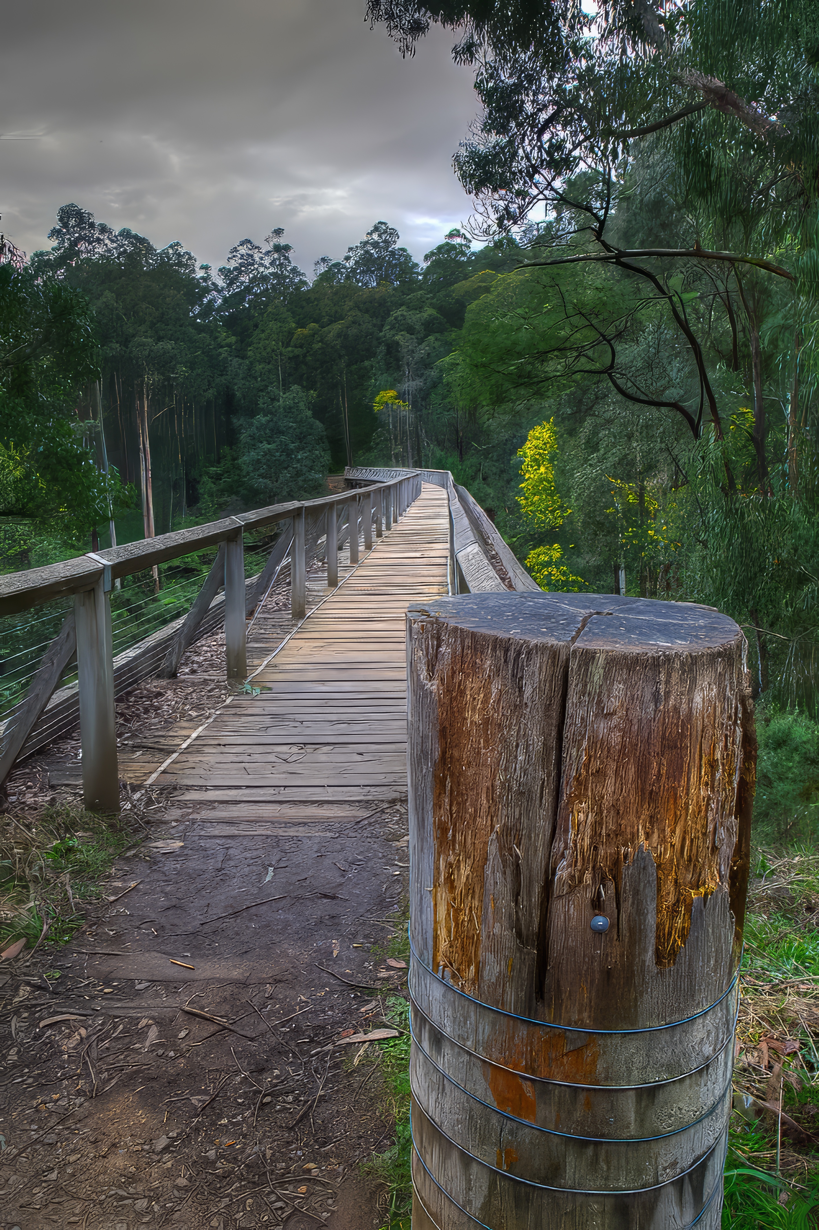
Noojee is a small former timber town in the wet foothills of the Great Dividing Range in West Gippsland. For photographers, the town is best treated as the centre of a much larger photographic area rather than as a single subject. Within roughly an hour's drive are waterfalls, rivers, mountain ash forest, cool temperate rainforest, historic railway structures, farmland, mountain scenery and, in winter, the possibility of snow at higher elevations.
The strongest subjects close to town are the Noojee Trestle Bridge, the Toorongo and Amphitheatre Falls, the Latrobe River and the old railway precinct. Farther out, the Ada Tree, Glen Nayook Rainforest Walk, Loch Valley and Mount Baw Baw broaden the area considerably. This makes Noojee particularly suitable for a weekend photographic trip: poor light for one subject can often be excellent light for another.
I have photographed this area on several visits. What keeps drawing me back is the combination of water, wet forest and old timber structures. The character changes markedly with rainfall, mist, autumn colour and winter weather.
Viewpoints
Noojee Trestle Bridge
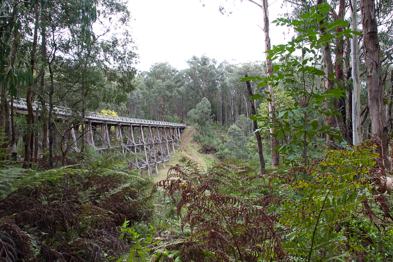
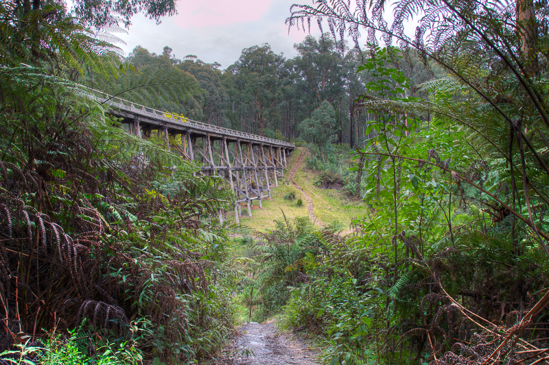
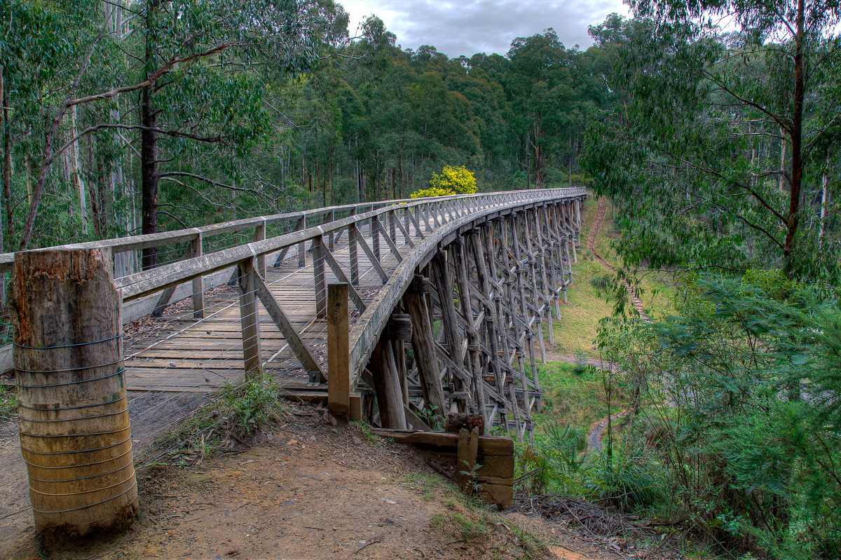
The trestle bridge is the area's most distinctive man-made subject. It is the tallest surviving timber trestle bridge of its kind in Victoria, approximately 21 metres high and 102 metres long. Photograph it from below to emphasise the timber geometry and scale, from the surrounding forest for an environmental view, and from the bridge deck for views along the old railway alignment. The bridge is particularly attractive in soft light, mist or after rain when the forest colours deepen.
Toorongo Falls
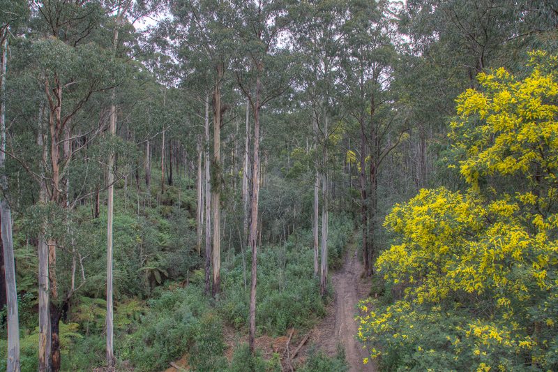
Toorongo Falls is the larger waterfall on the Toorongo and Amphitheatre Falls circuit, dropping about 25 metres through wet mountain forest. The principal viewing platform gives a strong view of the tiered fall, while the walk itself offers tree ferns, moss-covered rocks, river details and smaller cascades. A tripod and polariser are very useful here.
Amphitheatre Falls
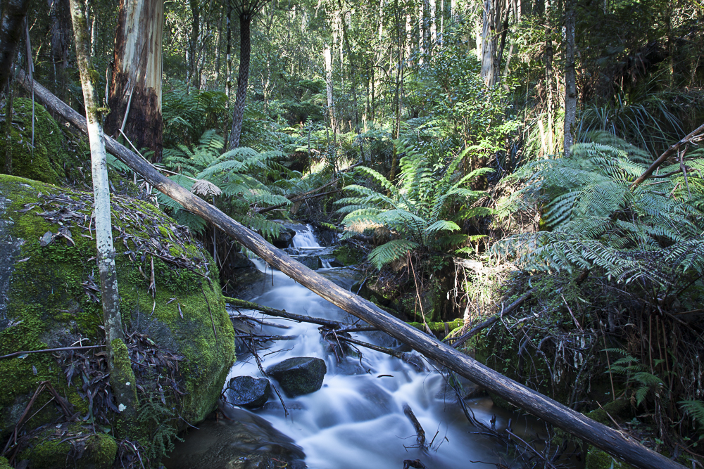
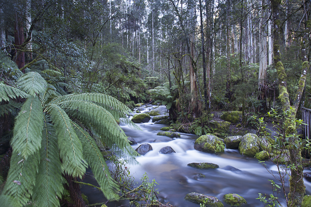
Continue around the same 2.2 km circuit to Amphitheatre Falls. It is smaller and more intimate than Toorongo Falls, with the viewing platform bringing the photographer close to the cascade. I regard the two falls as complementary subjects: Toorongo provides scale and drama, while Amphitheatre works well for tighter compositions of water, rock, ferns and wet forest.
Latrobe River and Noojee township
The Latrobe River provides quieter landscape opportunities around Noojee: flowing water, reflections, vegetation, bridges and small details. The historic railway precinct, including the restored J-class steam locomotive, also helps tell the story of Noojee's timber and railway past.
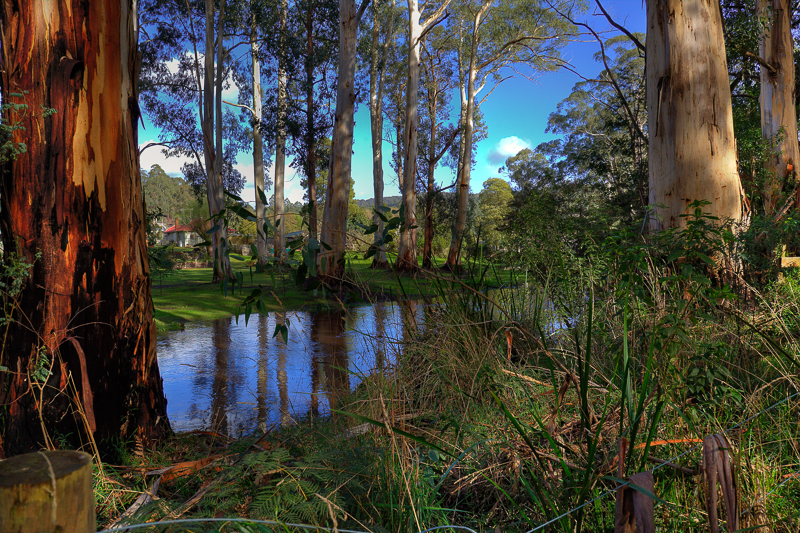
My earlier Noojee page also recorded a stay at the former Outback Retreat/Toolshed area beside the Latrobe River. I have retained those photographs as part of the page's photographic history.
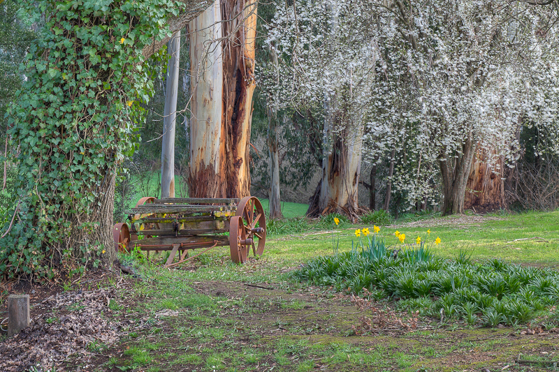
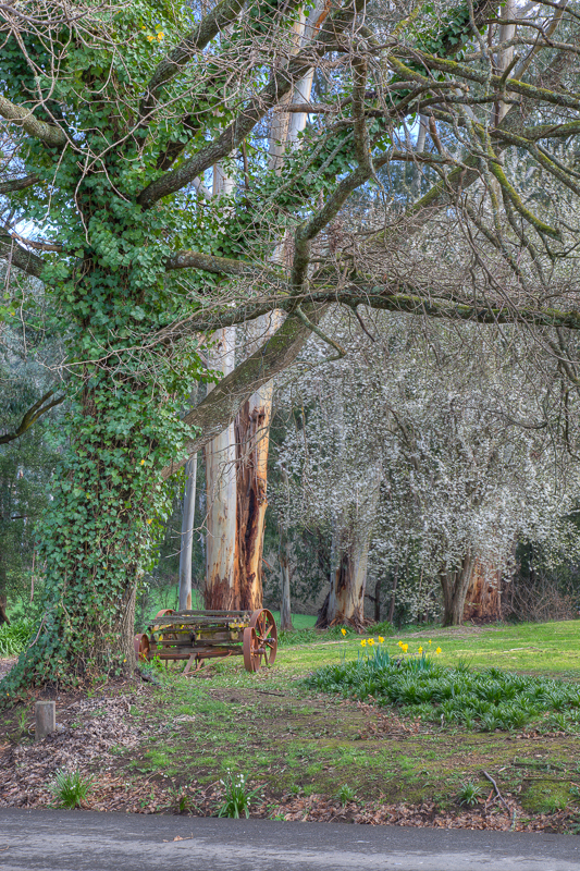
Loch Valley and surrounding forest
North of Noojee, Loch Valley adds forest roads, rivers, camping areas and seasonal colour. Checking Station is surrounded by native and pine forest and deciduous trees, making autumn particularly worthwhile. Take care on Loch Valley Road and Toorongo Road because logging trucks operate in the area.
Mount Baw Baw
Mount Baw Baw extends the photographic area into alpine country. It can provide snow, mountain forest, mist and broader landscape opportunities that are quite different from the wet gullies around Noojee. Conditions and road requirements can change quickly in winter, so check current alpine information before travelling.
Other Things to Look Out For
Forest and river details
Do not concentrate only on the headline attractions. Tree ferns, wet bark, moss, fungi, river stones, small cascades and reflections can produce some of the most characteristic Noojee photographs. A short telephoto is useful for simplifying the visually busy forest.
Mist, rain and changing weather
Noojee's wet climate is an advantage photographically. Overcast skies reduce contrast at the waterfalls, while mist can separate layers of forest and simplify compositions. Light rain also saturates foliage and darkens timber and rock.
Autumn colour
Although native forest dominates the district, introduced deciduous trees around some settlements and camping areas can add autumn colour. Checking Station in Loch Valley is specifically noted for its deciduous trees.
Wildlife and small subjects
Keep a longer lens available for birds and wildlife and consider a macro lens for fungi, moss and forest-floor details, particularly after wet weather.
Nearby Locations
I treat Noojee as the centre of a photographic area extending roughly 60 km, rather than limiting this section to the township itself. The following locations can be combined into one or more day trips.
- Noojee Trestle Bridge — about 3 km from town. Historic 21 m high, 102 m long timber trestle bridge surrounded by mountain ash forest.
- Toorongo Falls and Amphitheatre Falls — just outside Noojee. Two waterfalls on a 2.2 km forest circuit beside the Toorongo and Little Toorongo rivers.
- Noojee Railway Station Precinct and Rail Trail — historic railway material, a restored J-class locomotive and a forest rail trail linking the township with the trestle bridge.
- Ada Tree — a giant mountain ash about 76 m high in cool temperate rainforest. The 3.6 km Grade 3 loop takes about 1.5 hours.
- Glen Nayook Rainforest Walk — near Neerim Junction. A short walk following the Tarago River through fern glades and rainforest.
- Neerim South and Apex Lookout — rolling West Gippsland farmland, distant views and the nearby Tarago Reservoir landscape.
- Loch Valley / Checking Station — forest, river scenery and autumn colour north of Noojee.
- Mount Baw Baw — alpine and subalpine landscapes, mountain forest, mist and seasonal snow.
- Poplars Reserve — a riverside reserve on the Loch River, useful for quiet river and forest photographs and as a camping base.
Location
Noojee, Victoria 3833
Approximate township centre: -37.8947, 146.0009
Noojee lies in West Gippsland in the foothills of the Great Dividing Range, approximately 1 hour 45 minutes to 2 hours east of central Melbourne depending on traffic and route.
Apple Map – Location and Nearby Photographic Locations
This interactive Apple Map shows the principal Noojee photographic subjects and worthwhile nearby locations. Select a numbered marker or a location in the list below.
Photographic locations
How to Get There
From Melbourne, Noojee is normally reached by travelling east on the M1 towards Warragul/Drouin and then north through the West Gippsland hinterland via Neerim South and Neerim Junction. Allow roughly 1 hour 45 minutes to 2 hours from central Melbourne, depending on traffic and the route chosen.
A car is by far the most practical way to photograph the wider Noojee area because the principal subjects are spread across forest and mountain roads. The main roads into Noojee are sealed, while some approaches to forest attractions use gravel roads.
For Toorongo Falls, continue east from Noojee on the Mount Baw Baw Tourist Road and follow the signed turn towards Toorongo Falls Reserve. For the trestle bridge, follow the Mount Baw Baw Tourist Road west of Noojee to the signed access road.
Driving from the State Capital
The state capital is used as a consistent reference point. Apple Maps calculates the automobile route to this location; your actual route may vary with your starting point, traffic, roadworks and temporary closures.
State capital to destination
Calculating the driving route with Apple Maps…
Distance and travel time are Apple Maps estimates and may change with the route and current conditions.
Current Access / Conditions
Information checked September 2026. Current Victorian Government visitor information lists Toorongo Falls Reserve, the Toorongo and Amphitheatre Falls walk, Noojee Trestle Bridge, the Noojee Rail Trail and Ada Tree as visitor destinations. The pedestrian footbridge on the Toorongo Falls walk has recently been upgraded.
Forest conditions can change after storms, heavy rain, fire operations or road works. Logging trucks operate on some roads in the district; current advice specifically calls for caution on Loch Valley Road and Toorongo Road. Check current road, forest and alpine conditions before setting out, particularly if travelling beyond the main sealed roads or towards Mount Baw Baw.
Best Time to Visit
Winter and spring
These are my preferred seasons for the waterfalls and wet forest. Rainfall is generally more useful, moss and ferns are lush, and overcast weather gives softer light. Higher country around Mount Baw Baw may also provide snow in winter.
Autumn
Autumn can add colour around settlements and places such as Checking Station, while the native forest remains green. Cool mornings can also produce mist.
Summer
Noojee is often cooler than Melbourne and can be a pleasant summer escape, but waterfall flow may be less reliable. Forest fire risk also becomes an important planning consideration.
Time of day
For waterfalls and rainforest, even overcast light is usually more important than sunrise or sunset. Early morning is particularly useful for mist, quieter walking tracks and fewer people at the main viewpoints. Save open farmland, lookouts and mountain views for stronger directional light where possible.
Accessibility
Accessibility varies substantially across the Noojee area. The trestle bridge can be seen from the gravel parking area at its base, but reaching the bridge deck involves steep stairs. The Toorongo and Amphitheatre Falls circuit is about 2.2 km through wet forest with inclines, steps and surfaces that may become slippery.
The Ada Tree walk is a 3.6 km Grade 3 loop with uneven surfaces and natural steps. Noojee township and the railway precinct provide easier access for visitors who do not want a longer forest walk.
Most major attractions are reachable by 2WD in normal conditions, but this is forest and mountain country. Do not assume that every minor road shown by navigation software is suitable for an ordinary vehicle, caravan or large tow rig. Check the intended route before leaving the main roads.
Where to Stay
Although Noojee can be visited as a long day trip from Melbourne, staying one or two nights makes much more sense photographically because it allows early-morning forest and waterfall sessions and gives some protection against poor weather.
Toorongo Falls Campground
The closest camping base for the waterfalls. Campground One is currently free, requires no booking and accommodates tent and vehicle-based camping, including large caravans. Campground Two is flatter and suited to smaller caravans and campervans but is seasonally closed from early June until the September school holidays.
Current Toorongo Falls camping information
Poplars Reserve
A free, no-booking campground beside the Loch River about ten minutes from Noojee. Current government information says the larger campsites can accommodate caravans and camper trailers. It has toilets, picnic facilities and fire pits and is well placed for exploring the wider area.
Current Poplars Reserve information
Toorongo Valley Estate
A self-contained accommodation option in Toorongo Valley, useful for photographers wanting a comfortable base close to the waterfalls.
Noojee
The township and immediate valley have a small number of cabins, B&Bs and other accommodation. The Toolshed Bar, Bistro & Cabins and other local stays can be convenient if you want meals and accommodation close to the town's photographic subjects. Warragul and Drouin provide a much wider range of accommodation but are less convenient for dawn photography around Noojee.
Photography Recommendations
Standard zoom: probably the most useful single lens for the district. It covers the trestle bridge, waterfalls, river scenes and general landscape work.
Wide-angle: useful below the trestle bridge, in tall forest and when you want to place waterfalls or giant trees within their environment.
70–200 mm or similar telephoto: very useful for simplifying busy forest scenes, compressing layers of hills and isolating details in waterfalls, timber structures and mountain landscapes.
Tripod: strongly recommended for the waterfalls, rivers and low-light forest.
Polariser: particularly valuable around wet vegetation, rivers and waterfalls. Rotate it carefully rather than automatically using maximum polarisation.
ND filter: useful when you want slower water exposures in brighter conditions, although the forest is often dark enough without a strong ND.
Weather protection and lens cloths: rain and spray are part of photographing this district. Keep several dry cloths readily accessible.
Suggested Photographic Sequence
- Early morning: start at Toorongo Falls Reserve if conditions are overcast, wet or misty. Photograph Toorongo Falls, Amphitheatre Falls and river/forest details.
- Late morning: return towards Noojee and work the railway precinct, Latrobe River and township details.
- Afternoon: photograph Noojee Trestle Bridge from below, from the surrounding forest and from the bridge deck. Soft afternoon light or mist works particularly well.
- Second day: choose Ada Tree/Glen Nayook for wet-forest photography or Mount Baw Baw/Loch Valley for broader mountain and forest landscapes, depending on weather.
- Golden hour: use open viewpoints, farmland around Neerim South or elevated country if the sky is promising; stay in the forest if conditions remain soft and overcast.
How Long Should a Photographer Stay?
One full day is enough for the core Noojee subjects if you concentrate on the trestle bridge, township and Toorongo/Amphitheatre Falls.
Two nights / two full photographic days is my preferred minimum. It gives you two chances at early-morning conditions and enough time to add Ada Tree, Glen Nayook, Loch Valley or Mount Baw Baw without rushing.
Three or more days is worthwhile if you want to treat Noojee as the centre of the full 60 km photographic area, particularly when weather is changeable.
My Priority Photographs
- Noojee Trestle Bridge from below, showing the height and repeating timber structure.
- A wider trestle-bridge photograph placing the structure within the mountain ash forest.
- Toorongo Falls with strong water flow and controlled highlights.
- Amphitheatre Falls as a more intimate forest waterfall composition.
- Tree ferns, moss, river stones and smaller cascades on the waterfall circuit.
- The Latrobe River at Noojee in soft morning or evening light.
- Noojee railway heritage: station precinct, locomotive and rail-trail details.
- Ada Tree and surrounding cool temperate rainforest, using a person for scale if appropriate.
- Mist or layered forest around Loch Valley or the Baw Baw foothills.
- A seasonal image — autumn colour, winter snow or a particularly lush post-rain forest scene.
Photo Subjects
Explore related Auspano photography guides by subject.
Photographer Comments & Updates
Have you photographed this location? Share your photographs, viewpoints, photography tips or recent access updates, or ask a question about visiting. When uploading your own photographs, please include your name and the date each photograph was taken. Date any access or track-condition observations; visitor reports may become outdated, so check official information before travelling.