Photographing William Creek
About William Creek
William Creek is one of the few populated stopping points on the Oodnadatta Track. The tiny township has a great pub, an airfield (with flights over Lake Eyre), caravan park, meals and fuel. The township is about half way between Oodnadatta and Marree at some 200k from both. Given people travel at around 75km/hr here, this is around 2.5-3 hours from each.
Planning the photographic story
A varied set of photographs connects william creek settlement, railway history and desert with the wider setting. Begin with a broad view, then a tighter study and one distinctive detail.
Viewpoints
There is not a lot in William Creek
- The pub is the highlight of the town, and it is brilliant. It has good meals, good beer and a good outback atmosphere.
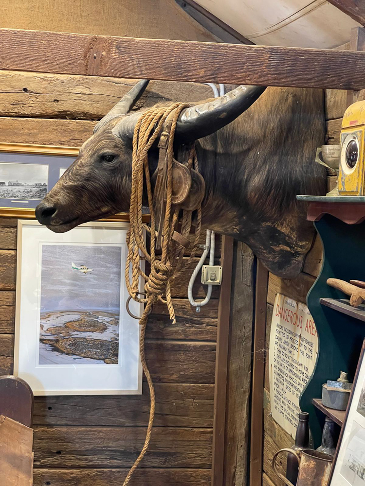
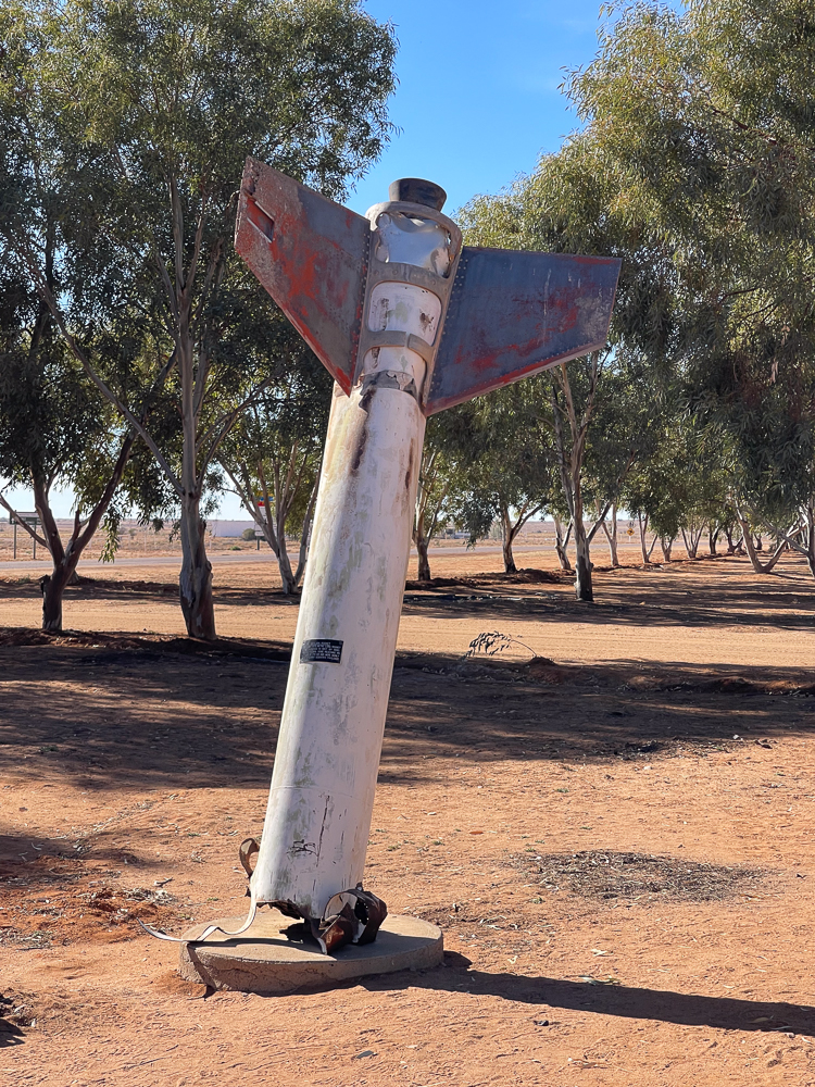
- There is an Outback Museum here. Given this is at the edge of the Woomera Missile Range, there are some nice relics of various rocket or missile flights.
Working the viewpoints
Start with a wide frame showing the settlement in its sparse setting, then photograph heritage details and the contrasting geometry of the track.
Other Things to Look Out For
How I photographed the William Creek Pub
What I took - what was in my kit
I took my LowePro Backpack loaded with Canon 5DRS body, Canon 24-70mm zoom, Manfrotto 190 Tripod, and of course a range of lens wipes, spare batteries, sunscreen and bug repellant. I tended to shoot 28-55mm
Techniques
This is tourist type photography. The sunlight is very harsh (except in the pub). I simply shot ISO 100 (for greatest fidelity), f10 (to avoid diffraction), and whatever speed allowed me to shoot to the right.
Nearby Locations
Nearby photographic locations
Location
William Creek, Far North, South Australia
Approximate coordinates: -28.90690, 136.33850
Markers identify photographic objectives rather than guaranteed parking spaces or open access.
Apple Map – Location and Nearby Photographic Locations
This Apple Map shows the principal subject and nearby photographic locations. Verify signs, road status and track conditions before relying on a marker for access.
Photographic locations
How to Get There
From Adelaide
Use the mapped Apple Maps route as a planning reference, then confirm road type, closures, fuel availability and final access with the relevant park or road authority. Allow extra time for photographic stops and changing conditions.
Driving from the State Capital
The state capital is used as a consistent reference point. Apple Maps calculates the automobile route to this location; your actual route may vary with your starting point, traffic, roadworks and temporary closures.
State capital to destination
Calculating the driving route with Apple Maps…
Distance and travel time are Apple Maps estimates and may change with the route and current conditions.
Current Access / Conditions
Conditions checked: 22 September 2026.
Outback road status can change within hours after rain. Check the South Australian Outback Roads map on the day of travel and obey every closure; fines and recovery costs can be substantial.
Carry water, fuel reserve, two sound spare tyres, communications and recovery equipment appropriate to the route. Do not rely on continuous mobile coverage or on every remote service being open.
Best Time to Visit
Best season and light
Choose a season that supports the defining subject, then favour the edges of the day for directional light. Overcast conditions are valuable for forest, moving water and detail; clear evenings suit silhouettes and night work.
Light in the field
Low side light defines corrugated surfaces and long shadows; clear nights may suit permitted night-sky work.
Accessibility
See Oodnadatta Track. The town - like the rest of the track - is essentially flat. No problems with access for anyone with wheel chairs or limited mobility. The town is not large, and it is pet freindly.
Field access and safety
Check track status, airfield boundaries and permission before photographing operational areas or entering private land.
Where to Stay
We stayed in the caravan park. There is camping allowed here, and there are cabins and hotel rooms for rent. See William Creek Hotel Accomodation. If you are staying here, I suggest a meal in the pub (there is no where else) - and a nice beer.
Photography Recommendations
Photography recommendations
- Begin with a clear environmental composition before concentrating on details.
- Use a tripod only where it will not obstruct a path, platform, jetty or working area.
- Bracket high-contrast scenes and protect important highlights.
- Use a telephoto to simplify distant layers and avoid approaching wildlife or fragile features.
- Revisit the principal viewpoint as weather, tide or light changes.
Suggested photographic sequence
- Arrive early enough to inspect access and choose safe viewpoints.
- Make the broad establishing photographs while the location is quiet.
- Work through secondary markers and detail subjects.
- Return to the main composition for golden hour or softer late light.
- Finish with blue hour only where the route back is straightforward and safe.
How long should a photographer stay?
1 night is a practical minimum. Add time when weather, water flow, tides or remote-road conditions are central to the planned photographs.
My priority photographs
- A defining environmental view of William Creek
- A tighter composition showing the location’s characteristic texture or structure
- A photograph using a person, vehicle, building or vegetation to communicate scale
- A low-light or weather-driven image that differs from the standard visitor view
Composition and exposure
Start with a wide frame showing the settlement in its sparse setting, then photograph heritage details and the contrasting geometry of the track. Low side light defines corrugated surfaces and long shadows; clear nights may suit permitted night-sky work. Review highlights and make a second deliberate framing rather than repeating the same viewpoint.
Suggested Photographic Sequence
Work through the location in an order that makes the best use of changing light and conditions.
Suggested field sequence
Begin with william creek settlement, railway history and desert. Follow with a tighter detail and a context photograph; return to the strongest composition if the light changes.
How Long Should a Photographer Stay?
Allow enough time to photograph the location in more than one light or weather condition where practical.
My Priority Photographs
Use this section for the practical photographic shot list for the location.
Priority frames
Secure an establishing photograph of william creek settlement, railway history and desert, a selective detail and one image that explains the surrounding setting.
William Creek gallery
Photographs of the principal views, details and changing conditions will be added here.
Photo Subjects
Explore related Auspano photography guides by subject.
Photographer Comments & Updates
Have you photographed this location? Share your photographs, viewpoints, photography tips or recent access updates, or ask a question about visiting. When uploading your own photographs, please include your name and the date each photograph was taken. Date any access or track-condition observations; visitor reports may become outdated, so check official information before travelling.